
Описание крыма кратко на английском
Обновлено: 05.07.2024
Свидетельство и скидка на обучение каждому участнику
Зарегистрироваться 15–17 марта 2022 г.
Описание презентации по отдельным слайдам:
2
Geography of Crimea
3
The Crimean Peninsula is completely surrounded by two seas: the Black Sea and the smaller Sea of Azov to the east.
Crimean peninsula was called Tauridia.
4
In the north Crimea is connected to the mainland by a narrow (8 km) Perecop isthmus.
5
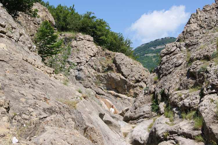
The Crimea consists of two very different parts — treeless steppe of the Crimean Lowland in the northern and central parts, and the Crimean Mountains in the south.
6
Crimean mountains stretch from west to east for 180 km, their width-50-60 km.
8
Ayu-Dag (Medved-gora) is the peak in Crimea. The peak is located 16 km north-east from Yalta between the towns of Gurzuf and Partenit.
9
Ai-Petri (translated from Greek as Saint Peter) is a peak in the Crimean Mountains. The peak is located above the city of Alupka and the town of Koreiz.
10
The climate there is subtropical. the Crimean Mountains stop cold winds from the north.
11
The largest rivers – the Alma, the Belbek and the Black.
the River Alma
the River Belbek
12
According to the population of Crimea occupies the 26th place among subjects of the Russian Federation.
Russian – 60 % , Ukrainians – 25 %, Crimean Tatars -10%.
Bakhchysarai is the former capital of the Crimean Khanate.
13
History of Crimea
14
Greek colonization of the Peninsula began in the 6th century B.C.
They built city-states: Panticapaeum, Feodosia, Kerkinitida, Hersonissos and Tiritaka.
15
In the summer of 1475 the Ottoman Turks landed in Crimea. In 1478, the Crimean khanate became a protectorate of the Ottoman Empire. Since the end of XV century the Crimean Khanate carried out regular raids on Russian state and Poland. The main purpose of the raids was to capture slaves and their resale to the Turkish markets.
16
The Russo-Turkish wars were a series of wars fought between the Russian Empire and the Ottoman Empire between the 16th and 20th centuries. It was one of the longest series of conflicts in European history.
In total, 11 Russia-Turkish wars cover a period 241 year.
18
During the Russian Civil War, Crimea was controlled by the White Army. After they were defeated by the Red Army, Crimea became part of the Soviet Russia.
In the Second World War the peninsula was occupied by Nazi Germany for several years.
In 1954, it was transferred to the Ukrainian Soviet Socialist Republic within the Soviet Union. In 1991, it became part of independent Ukraine.
19
March 18, 2014 Crimea (including the city of Sevastopol) joined to the Russian Federation.
20
Cities and tows
21
Simferopol is the administrative center of the Republic of Crimea. The population is about 360 000 people.
22
Sevastopol (the Greek name - Hersonissos) - a city located in the south-west of the Crimean peninsula on the Black Sea coast. Laid by the decree of Russian Empress Catherine II in 1783.
23
Sevastopol is the naval base of the Black Sea Fleet of the Russian Federation.
25
In 1954 Sevastopol was awarded the order of the Red Banner, in 1965 the city was awarded the title hero City, and in 1983 was awarded the Order of October Revolution.
26
Southern coast of Crimea is one of the most important and popular resort areas in former USSR includes the cities-resorts Alupka, Yalta, Alushta, Sudak and the numerous settlements.
27
Big Yalta includes Alupka, Gaspra, Gurzuf, Koreiz, Livadia, Massandra, Simeiz, Foros.
28
Evpatoria - one of the oldest cities in the South of Russia. Near Evpatoria there are a number of salt lakes with mineralized water of different chemical composition.
29
Sudak is well-known tourist resort and the centre of the wine industry.
Artek - international children's center in Crimea. Located in Gurzuf. In the past, it was the most famous pioneer camp of the USSR.
34
Places of interest
35
Livadia Palace was a summer residence of the last Russian tsar, Nicholas II. The Yalta Conference was held there in 1945, when the palace housed Franklin Delano Roosevelt and other members of the American delegation. Today the palace is a museum, but it is sometimes used for international summits.
36
Yalta Conference in February 1945 with (from left to right) Winston Churchill, Franklin D. Roosevelt and Joseph Stalin.
37
Massandra Palace of Alexander III is located in Upper Massandra.
Vorontsov Palace is one of the jewels of the Crimea.
The Palace was built as the Crimean residence of the Governor-General of the Novorossiysk territory of count Mikhail Vorontsov.
41
The Swallow's Nest is a decorative castle located at Gaspra, a small town between Yalta and Alupka. It was built between 1911 and 1912 , on top of the 40-metre high Aurora Cliff by the Russian architect Leonid Sherwood for the Baltic German oil millionaire Baron von Steingel.
43
Dacha of Gorbachev in Foros - in the USSR state dacha № 11, where Mikhail Gorbachev put under house arrest in 1991.
45
Nikitsky Botanical Garden is one of the oldest botanical garden. It was founded in 1812 and named after the settlement Nikita.
49
thank for your attention !
Краткое описание документа:
- подготовка к ЕГЭ/ОГЭ и ВПР
- по всем предметам 1-11 классов
Курс повышения квалификации
Дистанционное обучение как современный формат преподавания

Курс повышения квалификации
Инструменты онлайн-обучения на примере программ Zoom, Skype, Microsoft Teams, Bandicam
- Курс добавлен 31.01.2022
- Сейчас обучается 30 человек из 19 регионов

Курс повышения квалификации
Специфика преподавания английского языка с учетом требований ФГОС
- Для учеников 1-11 классов и дошкольников
- Бесплатные сертификаты учителям и участникам
Дистанционные курсы для педагогов
Найдите материал к любому уроку, указав свой предмет (категорию), класс, учебник и тему:
5 613 093 материала в базе
- ЗП до 91 000 руб.
- Гибкий график
- Удаленная работа
Самые массовые международные дистанционные
Школьные Инфоконкурсы 2022
Свидетельство и скидка на обучение каждому участнику
Другие материалы
Вам будут интересны эти курсы:
Оставьте свой комментарий
- 05.05.2021 272
- PPTX 10 мбайт
- 5 скачиваний
- Оцените материал:
Настоящий материал опубликован пользователем Померанцева Татьяна Станиславовна. Инфоурок является информационным посредником и предоставляет пользователям возможность размещать на сайте методические материалы. Всю ответственность за опубликованные материалы, содержащиеся в них сведения, а также за соблюдение авторских прав несут пользователи, загрузившие материал на сайт
Если Вы считаете, что материал нарушает авторские права либо по каким-то другим причинам должен быть удален с сайта, Вы можете оставить жалобу на материал.
Автор материала
40%
- Подготовка к ЕГЭ/ОГЭ и ВПР
- Для учеников 1-11 классов
Московский институт профессиональной
переподготовки и повышения
квалификации педагогов
Дистанционные курсы
для педагогов
663 курса от 690 рублей
Выбрать курс со скидкой
Выдаём документы
установленного образца!
Учителя о ЕГЭ: секреты успешной подготовки
Время чтения: 11 минут
Онлайн-тренинг: нейрогимнастика для успешной учёбы и комфортной жизни
Время чтения: 2 минуты
Минтруд предложил упростить направление маткапитала на образование
Время чтения: 1 минута
Россияне ценят в учителях образованность, любовь и доброжелательность к детям
Время чтения: 2 минуты
Отчисленные за рубежом студенты смогут бесплатно учиться в России
Время чтения: 1 минута
Рособрнадзор предложил дать возможность детям из ДНР и ЛНР поступать в вузы без сдачи ЕГЭ
Время чтения: 1 минута
Новые курсы: преподавание блогинга и архитектуры, подготовка аспирантов и другие
Время чтения: 16 минут
Подарочные сертификаты
Ответственность за разрешение любых спорных моментов, касающихся самих материалов и их содержания, берут на себя пользователи, разместившие материал на сайте. Однако администрация сайта готова оказать всяческую поддержку в решении любых вопросов, связанных с работой и содержанием сайта. Если Вы заметили, что на данном сайте незаконно используются материалы, сообщите об этом администрации сайта через форму обратной связи.
Все материалы, размещенные на сайте, созданы авторами сайта либо размещены пользователями сайта и представлены на сайте исключительно для ознакомления. Авторские права на материалы принадлежат их законным авторам. Частичное или полное копирование материалов сайта без письменного разрешения администрации сайта запрещено! Мнение администрации может не совпадать с точкой зрения авторов.
Топик Крым рассказывает о Республике, расположенной на Крымском полуострове, отделенном от России Керченским проливом. Республика Крым расположена между двумя морями: Черным и Азовским. Столица - Симферополь. На севере и в центре полуострова преобладают степные районы, на юге – горы, покрытые лесами и высокогорными пастбищами. У подножия гор – Южный берег Крыма, со средиземноморским климатом и растительностью. Реки короткие и неглубокие, есть соленые озера. Республика богата природными ресурсами, развиты тяжелая промышленность, пищевая промышленность, растениеводство, виноградарство и животноводство. Основные морские порты: Керчь, Феодосия, Ялта, Севастополь и Евпатория.
The republic is situated on the Crimea peninsula. It is between the Black Sea in the west and south, and the Sea of Azov — in the east. In the east the Crimea is separated from Russia by the Kerch Strait.
The total area of the republic is 26 100 km2, population is 2 137 700. It is divided into 15 regions and 15 cities.
Symferopol is the administrative centre of the Crimea.
The Crimea consists of two very different parts — treeless steppe of the Crimean Lowland in the northern and central parts, and the Crimean Mountains in the south.
The Crimean steppe, with its continental climate and steppe soils, occupies four-fifths of the territory.
The Crimean Mountains consist of a narrow range of foothills and a low mountain chain covered with forests and high pastures. Below the mountains in the south there is a narrow coastal lowland — the Crimean southern shore — with a Mediterranian climate and vegetation.
The rivers are short and shallow. On the northern slopes of the Crimean Mountains we find the Chorna, the Belbek, the Kacha, the Alma, the Salhyr and other rivers. There are also salt lakes there, such as the Sasyk, the Aktash and others.
It is rich in natural resources, such as iron ore, natural gas, building materials, and salt from the lakes. Russians constitute 65.2 percent of the population, Ukrainians — 15.99 percent and Tatars - 14.9 percent.
Food production is the Crimea's main industry. Food industry produces canned goods, fish and wines. Agriculture mostly specializes in plant-growing, vine-growing and animal husbandry. It is followed by iron-ore mining, metallurgy and machine-building.
The main sea-ports are Kerch, Feodosia, Yalta, Sevastopol, and Yevpatoria.
The artist I. Ayvazovsky and the polar explorer I. Papanin were born in the Crimea.
The most northward good sea beach in Crimea is in the Portovoye village (10 km to the north from the local center, Razdolnoye). Earlier this place was called Sary-Bulat (the Golden Blade). The shallow bay, cutting deep inland, is protected from the north by the chain of the Lebyazhi Ostrova, and the sand, that is truly of a golden color due to a little inclusion of iron compounds, consists of finely ground mollusk’s shells.

There is plenty of sun in this area, but spacious beaches are not numerous: out of the 120-kilometer coastline of the Tarkhankut Peninsula only 30 km are available for comfortable mass recreation. Читать далее О Крымском мысе Тарханкут на английском и на русском. North West coast of Crimea. Cape Tarkhankut →

Вид на Гурзуф, скалу Верблюд с руинами генуэзской крепости и Адалары с троллейбусной трассы
Особенно замечательный вид открывается с Гурзуфского автомоста (он и сам по себе необычен своей изогнутой по дуге формой). В центре просторной долины возвышается Генуэзская скала, напоминающая огромного двухгорбого верблюда. На ней сохранились руины генуэзской крепости ХI-XV веков и внушительный тоннель в скале, пробитый для наблюдения за морем в Средние века. Но первая крепость была возведена на этом месте еще раньше — в VI веке византийцами.
За ней в уютной Гурзуфской бухте, защищенной мощью Медведь-горы, словно плывут скалы-островки Адалары. Читать далее Gurzuf & Artek in Crimea, Black Sea. Гурзуф, Артек и Медведь-гора. На английском и русском →

Большая Ялта — особая административная единица Республики Крым. Она протянулась вдоль Черного моря на 70 км от Медведь-горы на востоке (от поселков Гурзуф и Краснокаменка) до поселка Форос у мыса Сарыч на западе.
Читать далее Большая Ялта. Big Yalta. На русском и английском →
В Симферополе решили ликвидировать Центральный автовокзал. Уже с десяток лет, или больше, с тех пор как появилась автостанция Курортная, он выпал из транзитного потока, стал центральным только для крымчан. Теперь его просто снесут. Уже высится над ним офисный центр. Сварганят элитные апартаменты, втиснут очередной нахрен ненужный торгово-развлекательный центр. И это все без парковок и без расширения проезжей части.
Все-таки. Как и откуда симферопольцам ездить по Крыму? Как неместным студентам Крымского университета отправляться по домам на выходные?
Как крымчанам в один клик, один билет приезжать в центр столицы полуострова?
Читать далее Зачем, для кого и как сохранить Центральный автовокзал Симферополя? →

К Верхней станции канатной дороги Мисхор – Ай-Петри, откуда начинается тропа к Зубцам Ай-Петри можно попасть из поселка Мисхор к западу от Ялты, а также на маршрутном такси, которое отправляется от Ялтинского автовокзала. Однако эта экскурсия будет неполной, если не посмотреть Большой хаос Алупкинского парка, также к западу от Ялты. Лучшие места для отдыха и лечения: Мисхор, Симеиз, Алупка. На Ай-Петри сноубордисты отправляются также из Севастополя.
Схема Ай-Петринской яйлы и массива Бойка (искажение от Пойка, автор нам не известен пока.
Читать далее Ay-Petri Mountain Плато Ай-Петри: зимний спорт и горный туризм →
Arpat is a small mountain village in the foothills of Karabee plateau of the South-East of Crimea. This Plateau is above the village and one of the most inspiring places of Crimea with the remarkable gorges and the mountain ridges which offer the spectacular views of the sea and surrounding of these mountains.

Arpat is a small mountain village in the foothills of Karabakh plateau in the South-Eastern Crimea. Plateau above the village — one of the most inspiring places in Crimea with the remarkable gorges, scenic trails and mountain ridges that offer spectacular views of the sea and surrounding mountains.
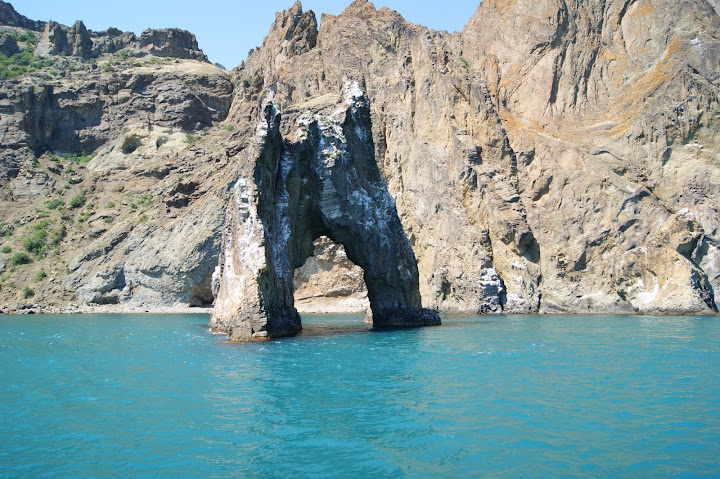
Karadag Reserve lies between the two cities known as Feodosia and Sudak, which are situated on a piece of the Crimean peninsula on the south-east coast. Karadag is a historical geology . It’s a solitary rocky shoreline massif of the Jurassic period created about 150 – 160 million years old . Not forgetting the variety of delicate flora and fauna arrayed in this little reserve.. Inside the reserve you’ll find a severe and unique splendor through elevations of 577 meters above the Black sea level . There are plenty of mystical minerals < agate, amethyst, jasper, opal and others >in Karadag . Karadag is a netural museum of Crimea . In this exceptional ecosystem also you’ll find more than 1.700 plants as a pistachio tree, fir forests, hombeam, ash, downy oak and broad-leaved forest, grass meadows, mixed herbs and crimean medicinal plants like Rosa canina . Today the reserve covers not only this beautiful and varied landscape but also 809 hectares of the Black Sea which is included in the total 2874.2 hectares of the Karadag Natural . Golden Gate in Karadag is the most beautiful place of Karadag .
The climatic conditions of the Crimea are very diverse. It is surrounded by a water basin, has full inclinations to the north and steeper sea (to the Black Sea), which is protected from the influence of northern winds. Mountains cut valleys. All conditions affecting the nature of the climate.
The temperature of the air in the shade, as well as the maximum and minimum temperature of the air in the same place and the amount of precipitation falling annually.
Перевод:
Климатические условия Крыма очень разнообразны . Он окружен водным бассейном, имеет полные склонности к северу и более крутому морю (к Черному морю), который защищен от влияния северных ветров. Горы прорезаны долинами. Все условия, влияющие на характер климата.
Температура воздуха в тени, а также максимальная и минимальная температура воздуха в том же месте и количество осадков, выпадающих в год.
Читайте также: